


 19 / 52

SEPTEMBER-OCTOBER 2017
SPACE CHRONICLES
ice that subsequently inter-
acted with the ancient, vol-
canic mountain rocks.
Numerous craters in vari-
ous states of degradation
pockmark the entire scene,
testament to the region’s
long history. Perhaps the
most noticeable craters are
the two situated side by
side close to the centre of
the scene (below), their
breached crater walls con-
necting them and giving the appear-
ance of a figure of eight shape.
Another interesting crater lies to the
left, nestled into the side of a hum-
wider crater, punching through to
deeper layers below. The rich diver-
sity of geologic features in this re-
gion – and in this image alone –
showcases the dynamic environment
the planet has witnessed through
time, evolving from a warmer wetter
climate that enabled liquid water to
flow freely across the surface, to the
arid world that we see today.
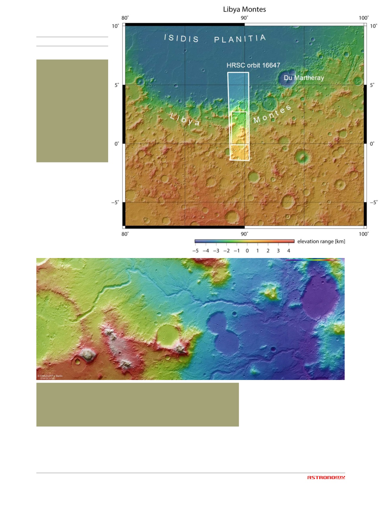
T
his map shows the lo-
cation of Libya Montes
in context of the sur-
rounding region. The re-
gion outlined by the larger
white box indicates the
area imaged during Mars
Express orbit 16647 on 21
February 2017. The small
box in the centre high-
lights the focus of the as-
sociated image release. In
this context image, north
is up. [NASA MGS MOLA
Science Team]
T
he colour-coded topographic view shows relative heights and depths of ter-
rain in the Libya Montes region on Mars. As indicated in the key at top right,
whites and reds represent the highest terrain, while blue/purple is the lowest.
The color-coded topographic view is based on a digital terrain model of the re-
gion, from which the topography of the landscape can be derived. [ESA/DLR/FU
Berlin, CC BY-SA 3.0 IGO]
mocky mountain. Inevitably, its rim
collapsed onto the valley floor be-
neath. Further left again, and a small
crater has imprinted into the larger,
!